This site uses cookies. By continuing, you agree to their use. Learn more, including how to control cookies.
Advertisements
THERE are certain things in this world on which you should never depend and one of them is the weather forecast. I???ll think of a few more before I???m through, but the weather forecast will suffice for now. The outlook for this morning in the northern Pennines is clear skies with a thin veil of cloud drifting in this evening. So my day has been organised around ??? and depends upon ??? this exceptionally fine winter weather . . .
The plan is to leave the van at Dufton, near Appleby, follow the Pennine Way long-distance footpath northwards to the summit of Great Dun Fell, double-back along a snowy Pennine escarpment to photograph the sunset in High Cup, then descend to Dufton in the fading light, using my headtorch if necessary.
This is a round trip of 14.5 miles (23km) and will reach an altitude of 847m (2,778ft) on Great Dun Fell ??? the second-highest peak in the Pennines after its neighbour, Cross Fell. There will be two highlights: the radar station on the summit of Great Dun Fell and the magnificent geological extravaganza that is High Cup. Descending snowy Pennine slopes in the golden embers of a winter???s evening might qualify as a third highlight, but that depends on the plan and weather working in harmony.
Here???s another thing on which you should never depend: old Ordnance Survey maps. My Sheet 91 (published in 1979) predates the Appleby bypass by a decade at least and I miss the Dufton turn-off. This sort of thing happens all the time but usually involves recently-planted forests and footbridges that were washed away twenty years ago. Old dogs, new maps . . . as they say. (Click pictures for high-res versions)
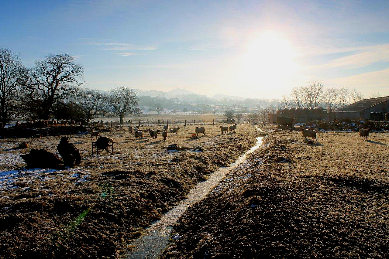
Dufton is a beautiful old village on the edge of the Eden valley. It has a free car park and public toilet, a pub and a youth hostel. The last time I was here it also had a tea-shop, where I enjoyed a pot of Earl Grey and a slice of fruit cake after a pleasant day on the tops, but I read somewhere recently that it has closed its doors.
So in the crispest of February dawns, with a pale sun casting horizontal beams across the land, I set off along the Pennine Way and climb steadily above frozen fields to the pure white snow that cloaks the hilltops. In the west, the Lakeland mountains rise above a sea of grey-blue haze. It really is the most perfect morning. And already I can see my first target: the radar station on Great Dun Fell. Let???s talk about radar stations because they are sinister places and do not sit easily in the landscape.
Unlike Fylingdales on the North York Moors, which exists to attract Russian missiles and divert them from more valuable targets in the US, the Great Dun Fell radar station was built for peaceful purposes. According to Wikipedia, it is operated by the National Air Traffic Service and plays a crucial role in air traffic control. Manchester University used to operate a weather station up here and still has access to the site. Apparently, Great Dun Fell spends two-thirds of the year immersed in cloud, so it???s a particularly useful place for studying weather. That makes it a rubbish place for spotting aeroplanes ??? but not if you???re the owner of ???a randome containing primary surveillance radar (PSR) and secondary surveillance radar (SSR) antennae???. In plain English, a giant golf ball and some aerials.
Great Dun Fell possesses something else that???s pretty unique for a mountain ??? a road to its summit. The public aren???t allowed to drive up this road because that would cause a nuisance. It exists to service the radar station and to access a telecommunications mast at the old Silverband lead and barytes mine.
So that???s where I???m going. I???m heading for a giant golf ball on the top of a hill. Incidentally, the giant golf balls at Fylingdales have been replaced by a giant segment of Toblerone chocolate. The Russians are confused but not sufficiently to prevent them wiping out Scarborough and Whitby after they???ve flattened Kiev. I just hope I???m back down at the van before Mr Obama decides to export arms to Ukraine.
I veer off the Pennine Way and intercept the road at the 686m (2,250ft) contour. Cloud is gathering on Cross Fell. By the time I reach the saddle between Great Dun Fell and Knock Fell a world of greyness exists and visibility is reduced to 150 metres. This isn???t what my Microsoft Corporation weather app predicted.
And with the greyness comes the most evil and consistent blast of northerly wind I have been forced to endure for many years. My beard freezes instantly. If you???ve never experienced a frozen beard you can???t begin to imagine what it feels like. Stick a pie crust to your face with wallpaper paste and put your head in the freezer for an hour and you???re about halfway there. It???s not particularly unpleasant, it just feels like you???ve got a pie crust stuck to your face.
Spindrift stings eyes and cheeks. Horizontal icicles dangle precariously from roadside snow poles. Banks of snow have drifted across the road, revealing bare patches of tarmac caked in a lethal sheen of ice. Progress is slow and difficult. This is the north Pennines in the depths of winter. This is sub-zero temperatures with a dangerous helping of wind-chill factor thrown in to sap energy reserves and penetrate the warmest clothing. Walking becomes extremely unpleasant in these conditions.
I reach the radar station at 1pm. It has taken me nearly four hours to climb the 5.5 miles (9km) from Dufton ??? twice as long as expected. As I huddle in a doorway drinking tea, I decide to abandon my plan to walk south along the escarpment to High Cup. It would be madness in this weather. And to achieve what? Pictures of a sunset that is not going to happen?
As I crouch there feeling sorry for myself, a shrew bounces across the snow as nonchalantly as you like, oblivious to the wind and Arctic temperatures. Who would have thought that such a delicate little mammal could exist in this hostile environment? Yet here it is, scampering about, conducting shrew business. What a marvellous little fellow.
A new plan is hastily conceived as the north wind roars through gantries surrounding the giant golf ball. I shall head south-west down the fell to Silverband Mine and rejoin the road. High Cup and a glorious sunset will have to wait. There will be other opportunities.
Click map for full-size version
I set a compass bearing and head off through drifting snow and howling wind towards the ruins of Silverband Mine. Beneath the mist, Cumbria stretches before my boots to the western mountains in pools of blue, grey and white. It???s a wonderful view, despite the cloud cover. All is not lost after all.
Silverband Mine was worked by the London Lead Company for galena, the ore of lead, during the 19th Century, though in the middle of the 20th Century it was mined extensively by the Laporte company for the mineral barytes. As recently as 2011, Silverband was producing barytes as an opencast mine (see footnote for YouTube video).
The Laporte company installed an aerial ropeway for transporting barytes from the mine to the dressing plant near Dufton, several miles down the fell. This pylon is about all that remains . . .
And finally, here???s a third thing on which you should never depend: the belief that a remote location on one of the highest points in the Pennines will be devoid of traffic cones. Silverband Mine is covered with them ??? traffic cones pinned to the ground with iron bars to prevent telecommunications mast people driving over the edge in mist. And to confuse the Russians.
FOOTNOTE:
THERE???S a video on YouTube taken by Keith Bainbridge, who was manager at the mine in 2011, just before it closed. It shows the effort put into getting to work during blizzard conditions. It???s worth a look. Click: Getting to work at the highest workplace in the UK