
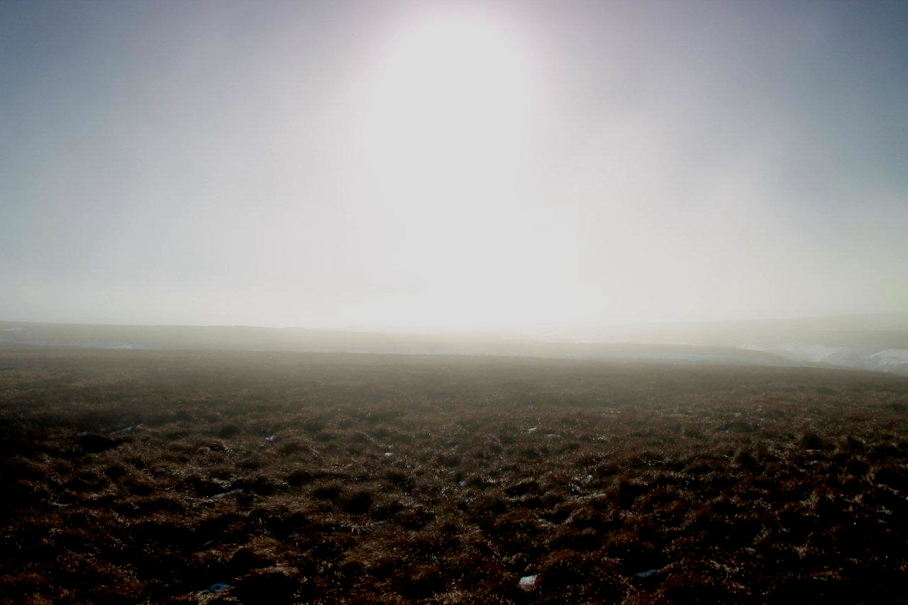
SOMETIMES when you walk through wild and lonely countryside you experience a creeping realisation that things haven???t always been the way they seem. The heathery moors to the west of Reeth, in the northern Pennines, are empty places except for a scattering of 19th Century lead mining remains and a few structures and tracks associated with grouse shooting. But a walk from Whaw to Tan Hill across Arkengarthdale Moor reveals some interesting features and points towards a darker past . . .
Today, men are burning heather on Arkengarthdale Moor. It???s a traditional practice ??? called swaling in some parts of the country. Patches of mature heather are burnt off to encourage nutritious green shoots for grouse to devour. This is how the moors are managed. It???s always been like this. Hasn???t it?
A young man on a quad bike overtakes me on the track that climbs towards Great Punchard Gill from the village of Whaw. He???s transporting gear to help with the burning. It???s a time-honoured scene: streams of grey smoke rising into a flawless blue sky from rolling moors. Gamekeepers controlling the flames. Grouse clucking and cackling in the undergrowth. The occasional clatter of wings.


On this beautiful February morning I have a flexible plan to walk across desolate countryside to the Tan Hill Inn ??? Britain???s highest public house. A right of way wiggles across the moors for just under seven miles (11km) to the pub doorstep. Nowadays, rights of way in landscapes such as these have lost a degree of their former significance because the Countryside and Rights of Way Act 2000 has opened England to the English. But they remain essential as navigational aids and historical timelines.

Click map for full-size version
I???m calling it a ???flexible??? plan because, according to my map, there is nothing up there except elevated bogs and featureless moorland, and I reserve the option to veer north at any given point to seek the variety offered by the old turnpike road.
But in a way it???s an adventure. It is country where my feet have never walked. And it has the added advantage of having a pub as its destination, even though the strongest drink I intend to purchase is tea.


My first interesting discovery in this land of grouse is a fine brace of lime kilns. And higher up Great Punchard Gill I stumble upon the remains of a colliery. So in distant times this was quite a busy place, with limestone quarrying and coalmining taking over from where the lead mining finishes. There was life before grouse, it seems. People laboured in this area before the genteel art of shooting became fashionable.


This practice was not confined to the Pennine dales. Before the advent of the railways brought cheap, high-quality coal to the remote valleys of England and Wales, digging peat was a way of life for a large percentage of the population.
Place-name elements such as ???turf???, ???moss??? and ???bottom??? are associated with the activity of peat-cutting. Up here, in the immediate vicinity of Arkengarthdale Moor, are many examples: Surrender Moss, Whetshaw Bottom, Turf Moor, Wham Bottom, Moulds Bottom, Flincher Bottom Moss (two for the price of one there), Little Punchard Gill Head Moss, Blakethwaite Moss and Mill Bottom. (See footnotes)
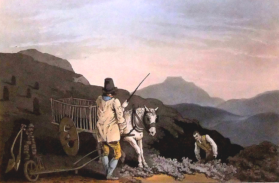
The Peat Cart, a painting by George Walker, 1814, from his Costumes of Yorkshire series. The mountain in the background is Ingleborough
So the industrial revolution did the land-owning classes several big favours. Not only did they benefit financially from the ownership of mineral rights and the exploitation of the riches beneath their estates, their moorlands were cleared of tiresome peasants as peat fell out of fashion. This state of affairs coincided with the advent of grouse-shooting as an exclusive activity. The rich couldn???t lose. But they never do.
Incidentally, turbary rights were never abolished; they became obsolete and so failed to be included when much of our common land was formally registered in 1965. Some areas retained their rights, one being Eskdale in Cumbria. Anyone wild camping on the Great Moss (there???s one of those telltale peat-cutting words again) beneath the Scafell range might have an argument for digging peat to cook their dinner if they are bolshie enough.


How did we ??? the lead-mining, coal-digging, wood-gathering, gorse-slashing, bracken-mowing, peat-cutting lowly folk ??? suddenly find ourselves in the position of being banned from our own hills? We didn???t consciously surrender our rights. We didn???t swap the privilege for the obvious advantages of an HSBC bank account in Switzerland complete with shell company in Lichtenstein. Yet somewhere along the twisting timeline of history the forces of low morality occupied the high ground and the rest of us were relegated from worker-cottager status to trespasser status.
Thankfully, the 2000 Act wrested our uplands from the grip of recalcitrant landowners and plonked them in the 21st Century in one swoop. But was it enough? Did that landmark legislation fall short of a greater good? I???m still smarting from being thrown off nearby Hoove by a landowner and his gun-toting gamekeepers in 1982. And I rather fancy having my turbary rights back.


I haven???t a clue where these strange names originate. But again they illustrate, to me at least, that when you gaze beyond the popular milestones that represent our past ??? Hastings, Magna Carta, the Tudors, Victoria ??? the finer details, and the labours and passions of ordinary people, can be found written in the landscape. And that???s proper history.

- Ingleborough Archaeology Group, A survey of the north-west flanks of Ingleborough 2007 -2011, Turbary Ground, by Yvonne Luke. This is a fascinating paper, in PDF format, for anyone wanting to learn more about our peat-cutting past.
- Digging Deep into the History of Peat, The Yorkshire Post.