
I ONCE heard a famous climber remark during a television interview that he never uses the term ???conquer??? in relation to climbing mountains because he finds it demeaning and presumptuous. How is it possible, he said, to conquer something that has cast its shadow over the world for 200 million years and will cast its shadow for 200 million more after your boots and bones have turned to dust?
I think there???s something in that. Nothing conquers mountains except the vastness of time and geological erosion. Anyway, that???s my thought for the day ??? and the day hasn???t quite begun yet . . .

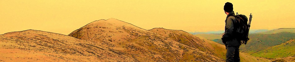
The sun is still asleep as I pull on my boots in the blackness of a lay-by. Across the valley, beyond the twinkling streetlights of Orgiva, the dark shapes of Spain???s Sierra Nevada mountains rise into the pre-dawn sky. Behind me stands the 1,877m (6,161ft) bulk of Sierra de Lujar, a mountain that has beaten me back on three occasions over the years. Today will be my fourth and most ambitious attempt.

Lujar was, apparently, and in geological terms, once part of Africa. This intriguing shard of knowledge was imparted to me last night by a nice lady called Lesley who was a bit the worse for drink but whose authority I have little reason to doubt. The great fault line between the tectonic plates of Africa and Spain runs directly beneath our holiday retreat in Orgiva, and not beneath the Mediterranean, as one might expect.
That explains all the empty bottles I tripped over on the patio as I carried my rucksack to the car. Sudden geological uplift and lateral thrust during the night. It set the farm dogs barking as well.
As mountains go, Lujar is a real challenge. It stands isolated from its neighbouring peaks and so all approaches are steep and arduous. Yes, there is a rough road leading to the radio and telecommunications masts on the summit, but because I am a stubborn Englishman I refuse to drive around the mountain just to plod up several kilometres of patchy tarmac.
The biggest challenge, though, is that Lujar has escaped the attention of the leisure map and guidebook industry ??? so I???ll be flying blind. Outdated military maps of the mountain do exist, I am told, but I have yet to see one.
So not only is Lujar big and bulky, it is very much a mystery. As I lock the car and plod through the luminescent dust of a mine track into the blackness before dawn, I am acutely aware that I really don???t know where I???m going.
Two or three people have contacted me in the past about climbing Lujar from the Orgiva side, because their experiences have been similar to mine: failures. So from this point on, here???s something you probably won???t find anywhere else on the internet or in print: a guide to climbing Lujar and ??? very important this ??? getting down again.

1) I march up Penon del Fraile, a deep ravine between two ridges along the bottom of which runs the steep mine road. The road is incredibly dusty because, after a gap of more than twenty years, the mines are now being worked again for fluorspar. I can hear engines rumbling in the darkness about 1,000ft above me. After passing a shepherd???s cottage with its mandatory barking dog, the track forks. The right branch continues to Mina Carriles, the fluorspar mine. I go left. A few minutes later I reach a second junction. Straight on ends in a jumble of crags and scree (been there, done it). Left takes me up a sharp slope back towards the Sierra Nevada, then curves round into the rising sun on the crest of one of Lujar???s great ridges.


Mulhacen, the highest mountain in mainland Spain

Orgiva sits beneath the slopes of Pico del Tajo de los Machos in the Sierra Nevada
2) A firebreak through the scrub, clearly seen from Orgiva, runs the length of the ridge from its foot on the Torvizcon road to a ring of crags girdling the summit. I follow a good path up the middle of the firebreak, which is pleasant in the gathering daylight because the scents of wild herbs ??? rosemary in particular ??? fill the air. The path peters out after passing beneath a huge fin of rock. This is the point of my highest and most recent failure. I stop for an early lunch.


3) From here it???s hard, sweaty and bloody work. Direction-finding is easy ??? I just keep to the crest of the ridge, which falls steeply on both sides. But the undergrowth of heather, broom, spiky gorse stuff, wild lavender and small crags that have to be skirted or climbed, makes progress slow and scratchy. Eventually the ridge broadens, and a long plod leads to the service road just beneath the first of the summit masts.


The ascent has taken, excluding breaks, about four hours. From the summit there are extensive views along the Costa del Sol. On a clear day Africa should be visible. There is too much haze today ??? but when you???re standing on a 6,000ft, 200 million-year-old lump of it, you don???t really care.

4) Mountain conquered ??? yes, bloody well conquered ??? I take a decision to return by a different route. As decisions go, this turns out to be one of the worst I???ve ever made. But I???m feeling cocky, so off I trot towards the furthest mast to descend along the ridge to the immediate west of the one I ascended, and complete a horseshoe walk through the old mines. The first kilometre or so is along a good path, but this fades to nothing on a wide plateau of bare rock, scrub and pine woods. With no map, I???ve nothing to guide me except the high peaks of the Sierra Nevada away to the north.
5) I blunder through successive waves of forest and dense, scratchy scrub, keeping a rough course towards Veleta and Mulhacen. Eventually, I chance upon a track leading down the mountain, but this soon veers away to the west. I plunge back into the brush. I had expected to reach the mines within minutes of leaving the summit, but all I can see is hostile scrubland descending on all sides.

It was a relief to find this track ??? until it veered 90 degrees to the west and went in the wrong direction
6) Like a startled Moses parting the waves of the Red Sea, I stumble through a particularly scratchy patch of waist-deep brush and emerge at the top of a firebreak. This I rattle down for several hundred feet ??? possibly a thousand or so ??? and arrive at the uppermost workings of the mine more than a little flustered. From here it???s just a matter of following the mine road down several thousand feet of zigzags to the shade of the Penon del Fraile ravine, pausing to watch underground face-shovels roaring in and out of tunnels with their buckets of fluorspar.


And now I???m sitting on the patio of the Casita La Luz, showered, patched up and about fifty per cent rehydrated, gazing up at this great lump of Africa towering above the tiled roof. Really, I didn???t conquer Sierra de Lujar ??? it allowed me to climb one ridge and descend another . . . while it established who was boss.
Now I???ve got some essential rehydrating to do. I???m expecting more sudden tectonic uplift as the evening progresses, so I wouldn???t be surprised if there are a few empty beer cans and the odd empty wine bottle rolling about on the patio when I get up in the morning.

FOR HIGH-RES VERSIONS OF THE PICTURES, CLICK ON AN IMAGE:


Now I know why your website is called Because They’re There and not Because They’re Beautiful. I mean, it’s hardly Scafell Pike, is it?
LikeLike
Beauty is in the eye of the beholder, Se??ora. Honestly. Yorkshire folk.
LikeLike
Well done that man ! I have a lot of catching up on your posts.
LikeLike
You shouldn’t spend so much time painting the house.
Cheers, Alen
LikeLike
10 out of 10 for perseverance Alen.!
There`s a Spanish version of the OS that has detailed 1:25000 maps of the country.You have to register an email address and tell them you want access for educational purposes before you can download them.I also had to install some software called Lizard Tech Geo Viewer in order to use them.Hopefully I`ve saved the link somewhere and can send you it.
Alex.
LikeLike
Wow. I didn’t know that, Alex. I’ve been climbing mountains in Spain since 2008 with 1:50000 maps that fall apart if you open them more than three or four times. I’ve reinforced all the folds with sticky-tape just to keep them together and patch the tears. I’ll look into that because we’re going back again soon.
Cheers, Alen
LikeLike
That looks pretty committing without a map, especially doing a circular. Looks a biggish day too. I assume you decided it would be better to start in the dark rather than finish in the dark. Either that or you were under strict instuctions not to be late back:-)
LikeLike
Hi David. Yes, it was the biggest day I’ve had for a while. I prefer to start early, that way it doesn’t matter much if you get lost temporarily. Also, it keeps the peace on the home front, which is always a good thing.
Cheers, Alen
LikeLike
That looks dry, dusty and painful! Somehow it looks even more difficult than a Scottish Munro. Well done for ‘conquering’ it this time!
LikeLike
Thanks Jo. That was dry, dusty and painful. But I expect I’ll get over it.
Cheers, Alen
LikeLike
Hi Alen,
A fantastic catalogue of the days events, I adhere to your quote ‘it allowed me to climb one ridge and descend another . . . while it established who was boss’ not on the same scale however, but I guess every fell walker can lay claim to this, well done Alen, you never gave up & now there’s horseshoe out there with your name on it.
LikeLike
Hi Paul. Thanks for that. Yes, I’ve noticed over the years that if you take mountains for granted, every so often they give you a bloody good scare or a bit of a kicking that brings you down to earth. Respect is the word.
Cheers, Alen
LikeLike
Hi i know this mountain well as i used to live on the coastal side in a village called gualchos and have walked many parts of it but never to the top ,well done it is a beautiful piece of rock and holds great memories for me.
LikeLike
Hi Henry. Lujar looks very rocky from the south side. We’re going over there again in November so I might take a walk around Gualchos because we’ve never been there. I’ve driven from Castell de Ferro up though Rubite and over the top a few times (a bit scary in places, if you ask me) and it’s wonderful countryside.
Cheers, Alen
LikeLike
Hi Henry
Just stumbled across your blog – some great descriptions & photos. We watch the sun setting over the Lujar from our house above Lanjaron, & have walked to the summit a couple of times – because it’s there! Agree about the 1:25000 maps – much better than 1:50000. You can buy paper copies from Stanfords for the whole of Sierra Nevada, which have footpaths marked.
LikeLike
Hi Jane. Over the past five of six years Lujar has become one of my favourite mountains. Whenever I visit Spain I look for its familiar shape, and when I see it from a distance then I know I’ve reached one of the best places on earth. We are looking to move to Orgiva sometime because I’m about to be made redundant, so then Anne and I will be able to watch the sun setting as well.
I’ve just had a look at your website. I didn’t know you chaps existed. What a great life.
Cheers, Alen
LikeLike
Thanks Alan. Yes, a good life; we really enjoy being in the mountains and the surrounding area. Hope yur plans come to fruition.
Jane
LikeLike
OK so how do you get over to the other side. I’ve slogged up the ridge to the radio mast a few times (beautiful but no stroll). I’ve also followed the mining road which goes all over the place eventually spewing me out somewhat short of energy over the top of Velez Benaudalla at some hydro poles from whence the only way down that I could find was hopping between abandoned farms coming out beside the highway by the Orgiva exit. What I want to find is a way over to Lujar or Lagos or Motril or somewhere useful like this. The distances are an issue. I ended up walking the road from Orgiva to Oleas and down to Castell del Ferro in order to complete my walk across Spain. Not very nice really except the road past Oleas.
LikeLike
Blimey Murray. That’s a big ask. The truth is I don’t know. But I’ve seen a video on Youtube of some Spanish guys setting off from the Orgiva side and walking down to Motril. I’ve often wondered about the southern side of the mountain because it looks a bit steeper and more rugged than the northern side, but I shall be going back shortly so perhaps I’ll be able to find out.
Half the trouble with Sierra de Lujar is because it’s so much smaller than the Sierra Nevada that, to people like me, it looks a doddle. But it’s a bloody big and extensive mountain. By English terms it is colossal.
A walk across Spain sounds like an ambitious project. I rather fancy that. And to finish at Motril or Castell de Ferro would be great.
All the best, Alen
LikeLike